A vigorous low-pressure system will develop across eastern Texas, tracking eastward across northern Louisiana and Mississippi throughout the day. This will increase both winds and instability in the atmosphere, which could lead to yet another round of severe weather across the south, unfortunately, some of the same places that saw it Easter Sunday.
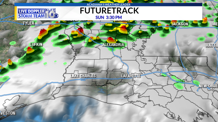
This is a very similar setup in the sense that most of the organized severe weather should remain to the north of us, mainly across northeast Louisiana, Mississippi, and Alabama. The atmopshere, even over Acadiana looks impressive featuring winds increasing with height and a very sharp temperature drop with height in the mid-levels. These are things we look for in regards to severe weather setups. The good news is that the lower-level of the atmosphere doesn’t look quite right for a widespread severe event. For starters, there looks to be another cap in the atmosphere, which may prevent rising air across Acadiana, which limits storm development. This is caused by a combination of a warmer layer of air just above the surface and a hint of drier air just above the surface.
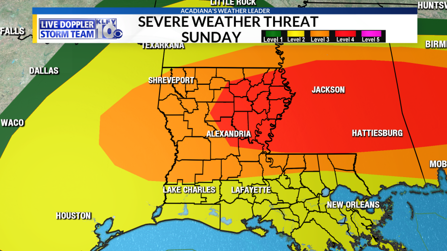
The ingredients above this layer look impressive, however, so if storms do manage to form they could cause some trouble. Really not seeing the turning with height of winds, so I don’t believe tornadoes will be a huge threat with this one across Acadiana. I think the main threats, if we do manage to get storms, will be hail and damaging winds. There is a slight window where things may try to come together for Acadiana and that would be during the late afternoon and evening hours. I believe this will be the time of day we’ll have to watch the most for any severe storm development. It would not surprise me, like with the Easter Sunday system, if Acadiana doesn’t see much from this system. I think most of the weather headlines will be coming out of the northeastern portions of the state, Mississippi, and Alabama. The Storm Prediction Center agrees as it has the highest risk in these areas, with a much lower risk across Acadiana. Northern portions of Acadiana, however, will have to monitor things closely.
Of course, we’ll continue to monitor things through the day. Keep it tuned to KLFY as we’ll be providing updates as needed. Behind this system, things look get Monday and Tuesday, with sunshine returning!
Download the KLFY Weather App for free by clicking here.