UPDATE, 2:16 p.m.: Vermilion and Cameron Parishes are currently under a Tornado Warning until 2:30 p.m.
1 P.M. UPDATE: All of Acadiana is under a Tornado Watch until 4 p.m. Lafayette, Acadia, Vermilion, Jeff Davis, Evangeline and St. Landry Parishes are under a Severe Thunderstorm Warning.
LAFAYETTE, La. (KLFY) – Strong to severe thunderstorms will be likely in Acadiana this Wednesday, October 27th, 2021 from 11:00 am to 5:00 pm.
Click here for a link to Live Doppler 10 Radar.
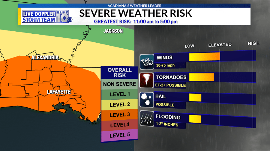
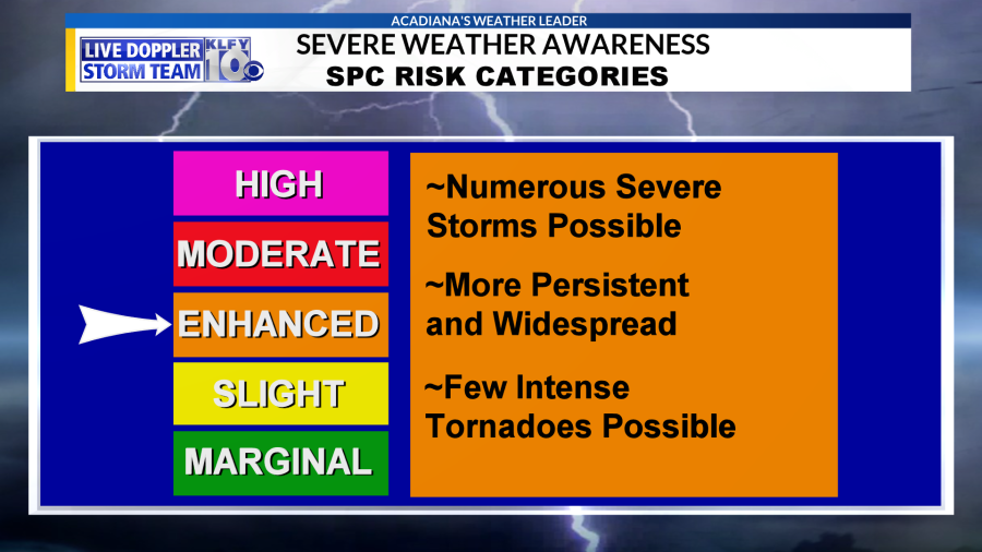
As we expected, the Storm Prediction Center has upgraded much of Acadiana into their “Enhanced Risk” Outlook. An “Enhanced Risk” is considered a 3 out of 5 for the likelihood to see severe weather in your area. This threat today is a bit higher compared to the usually severe threats in Acadiana. Damaging winds are the primary threat but tornadoes are possible too along with a threat to see stronger tornadoes.
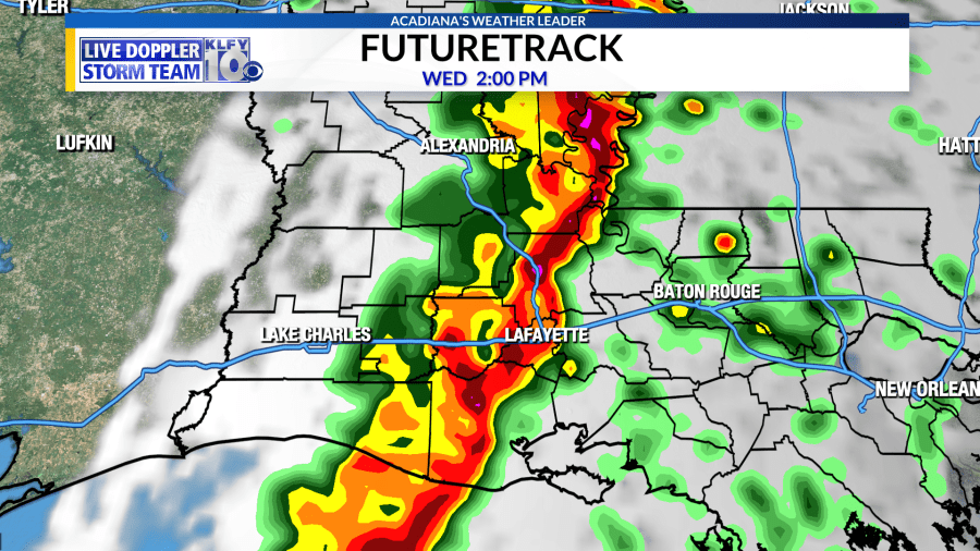
Timing is approximate but models are suggesting a line of storms approaching Acadiana late in the morning and moving through our area during the early afternoon hours. Our Futuretrack model has been consistent as it shows strong storms reaching Lafayette at approximately 2:00 pm today.
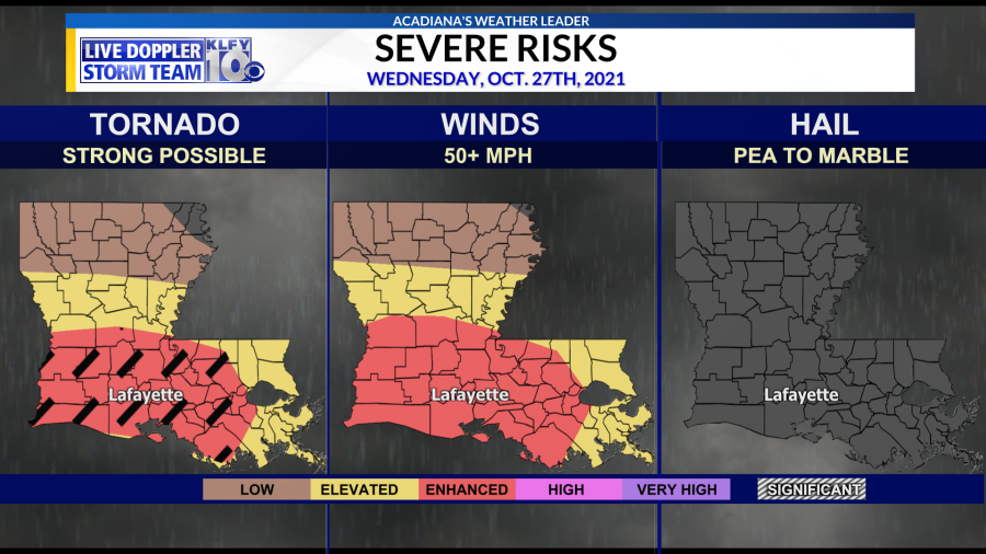
Notice how the SPC has added a “hatched area” to the tornado risk zone. This means there’s a potential for stronger tornadoes. Unfortunately, much of Acadiana is included in that hatched area.
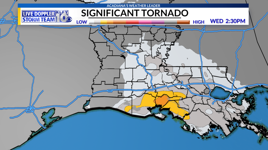
Checking on the Significant Tornado Parameter from the HRRR model. STP values increase slightly in Acadiana Wednesday giving us an indication that a stronger tornado can’t be ruled out. All of Acadiana should be weather-aware tomorrow.
Make sure to use the link above to download the Live Doppler 10 Storm Team Weather App.